
At first glance, the document raises eyebrows. Brothers Walter and William Artis, successful farmers in their own right, were sharecroppers for William S. Hagans, their first cousin?

A second document sheds some light:

Three days before he signed the cropper agreement, William M. Artis and his brother’s wife Hannah Forte Artis signed an agreement for the purchase of the same 68 acres. (Why Hannah and not Walter??? He was very much alive.) The land was more explicitly described as: (1) a tract on Turner Swamp, known as the Jonah Reid place, that Hagans inherited from his father Napoleon Hagans; (2) a tract, known as the Daniel Reid place, that William Hagans purchased from J.D. Reid and was once part of the lands of Washington Reid, deceased; and (3) a lot of “mud land” on Spring Branch for marl (a lime-rich mud used to condition or de-acidify soil.) The purchase price? A seemingly extravagant $5000 — $300 due at signing, $700 in a year’s time, and the remaining $4000 in two notes payable at 6% interest in 1918 and 1919. (Five thousand dollars in 1916 adjusts to about $106,000 today. That’s considerable change.) It appears then that, per the cropper agreement, during the first year of the purchase agreement the Artis brothers agreed to pay $300 worth of any crops they produced on the land to Hagans. (In addition to the $300 paid him in January?)
Napoleon Hagans built his house on a tract of land straddling Aycock Swamp, the next tributary over from Turner Swamp. (Both flow into Contentnea Creek.) Washington Reid’s mother Rhoda Reid was a well-t0-do free woman of color who owned considerable farmland in extreme northwestern Wayne County, perhaps the land that William Hagans eventually bought. The entire course of Turner Swamp runs only a few miles, the last stretch beyond Wayne’s borders into Wilson County. I am beginning to consider this area ground zero for the Reids. (Future project: a dig in the deeds.)
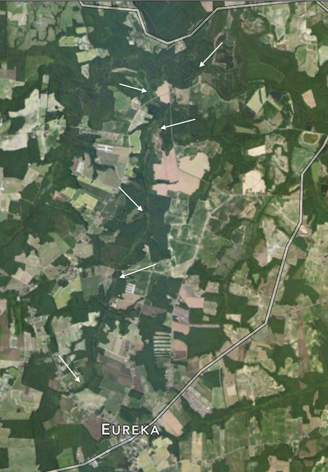
A little hard to see, but the arrows point out the course of Turner Swamp. The green curve just below the lowest arrow marks the rise of the waterway, and the top arrow points out its approximate mouth just below Woodbridge Road in Wilson County. (And “swamp” it is. The soil of eastern North Carolina is flat and sandy or clay-ey, and the little branches off major creeks don’t so much flow as they do stand, with the barest perceptible current. Getting to their banks often requires boots — and a stout stick to beat back the cane and catbrier.)

Great details and very interesting story indeed! Can’t wait to learn more as you unravel the mysteries!
Thanks, Dante!
Pingback: Confederate map tells all. | Scuffalong: Genealogy.
Pingback: Swamps and sandy loams. | Scuffalong: Genealogy.