
Last time I was at the North Carolina State Archives, I went looking for the original of this Confederate field map. I didn’t find it, but Trisha Blount Hewitt did.
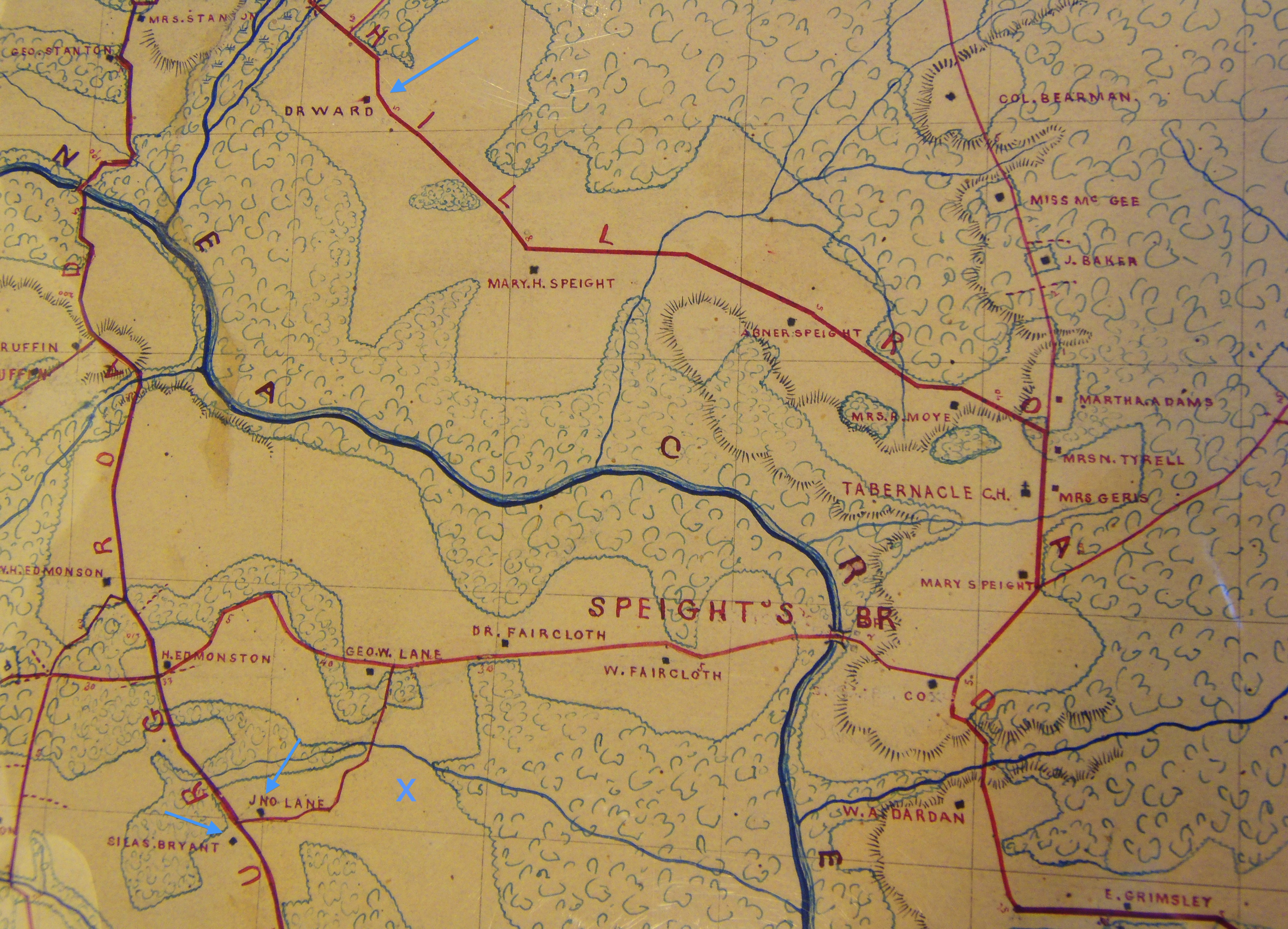
Dr. David G.W. Ward’s plantation is just below Stantonsburg at the top, and Silas Bryant and John Lane’s farms — where the Artises were apprenticed — are bottom left. X marks the approximate spot of the Artis Town cemetery.
More thanks to Trisha.

Pingback: More good folks of Greene County. | Scuffalong: Genealogy.
Did some of the Wilson Names turn into Artis?
https://www.ancestry.com/family-tree/pt/PersonMatch.aspx?tid=171530967&pid=252312174835&_phsrc=qiy62&_phstart=default&usePUBJs=true
I don’t know what you mean. Jack and Zilpha’s five children carried the surname Wilson. The Zilpha in your tree has incorrect info. Celia Artis’ daughter Zilpha Artis, a completely different person than Zilpha Artis Wilson, did not marry or have children. I featured her will (as well as those of her sisters) in a different blogpost.