
On 10 April 1900, Montraville Simmons and Dock Simmons of Howard County, Indiana, paid $6000 to the heirs of Israel Watts for this real estate:
Beginning at the North-west corner of said Section; thence West Twenty-eight -28- chains and Eighty-two -82- links to a stone; thence South Twenty-eight -28- chains and Seventy-one -71-links to a stone on the North Bank of the Wabash and Erie Canal; thence Westwardly along the North line of the Wabash and Erie Canal Eighteen -18- chains and Sixty-three -63- links to the East line of the Public Highway; thence South eastwardly along the East line of the Public Highway to the North Bank of the Wabash River; thence Eastwardly along the North line or meanderings of said Wabash River to the East line of said Section Twenty-nine -29-; thence North along the East line of said Section to the place of beginning, containing in said tract One Hundred and thirty-eight -138- acres, more or less.
Excepting from the Warranty the Wabash and Erie Canal and the P.C.C. and St.L.R.R. Co. right-of-way.
The decade that the family held the “Old Watts Farm” was a non-stop circus of squabbling with neighbors, domestic abuse and ruinous mortgages. (More on all that later.) In the middle of it all, Anna Henderson Simmons lay her burden down. After a few years tied up in Anna’s probate, and the deaths of Montraville Sr. and Jr., the property passed out of the Simmonses’ hands.
Astonishingly, though, the parcel is largely intact. Here it is in an undated (but perhaps mid 1930s) Cass County, Indiana Plat Book and Atlas, found at the Cass County Public Library:

And a 1951 map of Cass County prepared by Charles D. Murphy, Cass County surveyor (also found at the library):

And an up-to-date county plat map hanging in the Cass County Recorder’s Office:

And in a screen-capture from Google Maps:
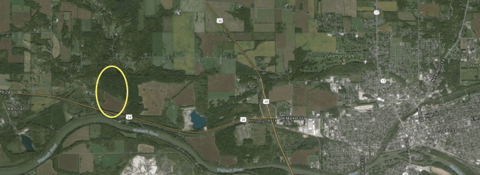
Highway 24 cuts across the bottom of the property running alongside the railroad (formerly owned by Pittsburgh, Cincinnati, Chicago & Saint Louis Railroad.) It’s difficult to tell where the canal once ran. Presently, there’s no road off 24 leading into the Simmons farm. However, if, headed west, you hang a sharp left onto Georgetown Road, you’ll pass under the railroad trestle and, on the left as the road curves to follow the Wabash River, you’ll see a private driveway that leads into what was Montreville’s riverfront. (Now occupied by Morels on the Wabash, offering cabins and campsites.)
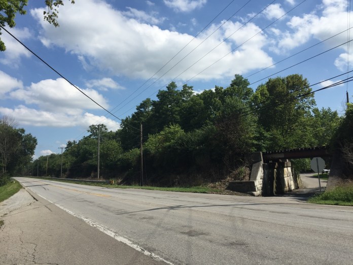
Looking across Highway 24 to the trestle over Georgetown Road. The land stretching away to the left (east) was Montreville Simmons’.

The Wabash River looking west.
Metes and bounds set forth in deed (that I copied, but neglected to write down the book and page numbers for), Cass County Recorder’s Office; photographs by Lisa Y. Henderson, August 2016.

Who of these is/are your relatives/ancestors? Had you planned this post before the tornado struck Kokomo a few days ago?
Anna Henderson Simmons was my great-great-great-grandfather’s sister. Incredibly, I didn’t hear anything about the tornado until I landed in Indianapolis yesterday.
Pingback: Indiana Chronicles, no. 3: Dock Simmons’ Logansport. | Scuffalong: Genealogy.