Enslaved People, Free People of Color, Land, Newspaper Articles, North Carolina, Paternal Kin, Vocation

Black carpenter makes name for himself.

I’ve been pulling together a descendant chart for Daniel Artis. In part, I want to keep the names straight and, in part, I’m trying to see if I’m related to any of the other Edwardses, Saulses or Artises I grew up with. Tonight I Googled some random names from this family and up popped this, published just three days ago in Kinston.com, the on-line version of the Kinston Free Press. Andrew Sauls’ father was Isaac Sauls, son of Isaac Sauls, son of Prior Ann Artis Sauls Thompson, daughter of Daniel Artis, brother of my great-great-great-great-grandmother Vicey Artis Williams.

[Update, 7 March 2014: I emailed the Free Press journalist and two days later — yesterday — got a call from Andrew Sauls himself! He lives on land his grandfather bought in 1920 (plus 400 more); confirmed that the Artis Town sign is gone; knew M.’s grandfather, “Cousin Booker T.,” well; and promised to show me around Sauls-Edwards-Artis territory next time I’m home!  — LYH]

Standard
Enslaved People, Land, North Carolina, Other Documents, Photographs

Dr. Ward’s house. And me.

After my recent rediscovery of a Confederate map that revealed the locations of several plantations significant to my genealogical research, I began searching for more information about John Lane, Silas Bryant and David G.W. Ward‘s landholdings. Pretty quickly, I found a link to a copy of a nomination form for the National Register of Historic Places Inventory, submitted for the Ward-Applewhite-Thompson house near Stantonsburg, North Carolina. This Greek Revival house, dating back to about 1859, was owned and occupied by several of the area’s leading planters — including “country doctor” D.G.W. Ward, who purchased it in 1857 — and it and its outbuildings are little changed from their antebellum forms.

As I read the detailed architectural description of the house and its setting, a tiny kernel of recognition began to form in the back of my mind. A big, white, two-story house? Set well back from the road? Just outside Stantonsburg? Could it …?

I scoured the maps attached to the nomination form, trying to lay them over the current topography. State Road 1539 … that would be Sand Pit Road today …  just east of a fork in the road and just north of the Norfolk & Southern Railroad (which was not there in Ward’s time) … and there it is, just like I remember.

sand pit road

Yes. Like I remember.

I’ve BEEN in this house. Many times, though long ago.

Growing up, my sister and I were very close to my father’s sister’s daughters. Our local family was quite small, but my cousin’s father came from a big family with deep Wilson County roots. Her grandmother had nearly a dozen siblings — whom we also called “aunt” and “uncle” — and we were often invited to attend their family gatherings. I remember best the delectable Easter, Thanksgiving and Christmas dinners gathered around tables groaning with food, but there were also the annual 4th of July family reunions at Aunt Minnie’s out in the country near Stantonsburg. The Barneses were tenant farmers for an absentee landowner and rented his large two-story house. We’d pull off the road into a sandy circular drive and park under the trees alongside cars with New York and New Jersey plates. I vividly remember my cousin’s great-uncles and cousins tending a barbecue pit in which a split pig roasted, chickens strutting among them.  A screened side porch protected platter after platter of home-grown, home-cooked goodness.  My memories of the interior of the house are vague: a central staircase, two large front rooms, the kitchen in back. (The staircase I remember mostly because, carefully tending a tall glass of lemonade, I missed a riser and slid down their length, smacking my ribcage against the steps and knocking the wind out of myself.)

I couldn’t believe it. It is exciting enough to identify D.G.W. Ward’s house and find that it is still standing, but to realize that I knew the house at which Appie and Mittie Ward had lived and worked as the enslaved children of their own father was uncanny.

IMG_4960Ward-Applewhite-Thompson House today.

Photo taken by Lisa Y. Henderson, February 2014.

Standard
Enslaved People, Free People of Color, Land, North Carolina, Other Documents, Paternal Kin

Confederate map tells all.

Years ago — 10? 15? — I ordered copies of two Confederate field maps from the fine folks at Wilson County Genealogical Society. (The originals are held at North Carolina State Archives.) The maps feature not only geographic markers, such as creeks and towns, but the names of landowners throughout the region. I remember intently scanning the area around modern-day Eureka, hunting for signs of my Artises and finding none. (Celia Artis is on one of the maps, but she’s not “mine.”) Disappointed, I folded them away in a box.

A couple of days ago, I stumbled across the maps while reorganizing some files. I let my eyes drift a little further afield and

SILAS BRYANT! JOHN LANE! DR. WARD!

jumped off the page.

Just like that, the locations of the farms on which Vicey Artis‘ children, including Adam, were apprenticed; Sylvania Artischildren were apprenticed; and Mittie Ward and Apsilla Ward Hagans were enslaved (by their father.) Not only that — with a little extrapolation from the 1860 census, I can determine approximately where my people were living during the War.

Here’s the first map (with my annotations in unfortunate grayscale, click to enlarge):

Confederate_Field_Map_2 annotated

The left edge of the map is defined by the Wilmington & Weldon Railroad. (2) Nahunta, bottom left and now the town of Fremont, is exactly halfway between Wilson, seat of Wilson County, and Goldsboro, seat of Wayne County. Follow the road east out of Nahunta on what is now NC 222, and you’ll see (3) Martinsville, now Eureka. Angle southeast from Eureka on what is now Faro Road, then veer right at the fork onto what is now Lindell Road. (See “B. Mooring”? Frances Seaberry and her family are listed near his household in the 1860 census.) After crossing a north-south road, pre-Lindell takes a sharp turn north. Drag your finger straight across from the bend and you’ll touch two squared names — Silas Bryant and John Lane.

Here is Bryant’s household in the 1850 census of Greene County:

silas bryant 1850

And on the next page:

john lane 1860

As reflected on the map, Silas Bryant and John Lane lived in close proximity, and, on their land, sisters Sylvania and Vicey Artis, who owned no property. My great-great-great-grandfather Adam Artis and his sisters Charity and Jane are listed in Bryant’s household, which suggests that they served him as involuntary apprentices under North Carolina’s laws governing the labor of the children of unmarried free women of color. (Both Sylvania and Vicey were married, of course, but to enslaved men — relationships that were not recognized under the law.) The 1860 census suggests that John Lane also had apprentices, Sylvania’s younger children. Lane may also have owned their father, Guy, who adopted the surname Lane after emancipation.

[And remember this?: “On 20 Aug 1853, in Greene County NC, Silas Bryant sold Daniel Artis for $325 120 acres adjacent to the mouth of a lane at the dividing line between said Bryant and John Lane, the Bull Branch, and the mouth of Sellers Branch.” I think Daniel was Vicey and Sylvania’s brother.]

Where is this now? Just inside the Greene County line, dotted at left, Highway 58 crosses over Speights Bridge Road. The second road on the left is the same one shown on the field map and is still called Lane Road. (9) marks the approximate location of Silas Bryant’s home and (10), John Lane’s.

Screen shot 2014-02-12 at 10.56.56 AM

Due north of Lane and Bryant, across Contentnea Creek is another boxed name, Dr. Ward. This was David George Washington Ward, physician, wealthy planter, and owner of twin daughters, Mittie and Appie, whose mother was an enslaved woman named Sarah. (More about the Wards elsewhere.)

Just inside the Greene County line, a few miles southeast of Stantonsburg in Wilson County, (11) marks the approximate location of Dr. Ward’s house today. [Update: Actually, it’s the approximate location of Dr. Ward’s name on the map. His house was, and is, in Wilson County close to Stantonsburg.]

Screen shot 2014-02-12 at 10.55.30 AM

Back on pre-NC 222, about a third of the way between Martinsville/Eureka and Stantonsburg, a road leads off to the east toward Watery Branch Church. (It still does — and is called Watery Branch Road.) Barely legible is the name of one of the few free people of color marked on the map: Celia Artis. Though not related by blood, at least in any immediate way, Adam Artis and his family are listed next to her in the 1860 census, and their descendants intermarried. (And share a cemetery that lies next to the road about where the C is in Celia.) Here, then, is the approximate location of Adam Artis’ earliest farmland. He later accumulated property all along the highway.

Other landmarks on the field map: (4) Toisnot Swamp (marked Creek here), a tributary of the Contentnea that flows down from Wilson County; (5) Contentnea Creek itself; (6) Black Creek, another Wilson County tributary; (7) Aycock Swamp, another tributary, upon whose banks Adam Artis’ brother-in-law and Appie Ward’s husband Napoleon Hagans built his house; and (8) Turner Swamp.

Standard
Land, North Carolina, Other Documents, Paternal Kin

68 acres on Turner Swamp.

At first glance, the document raises eyebrows. Brothers Walter and William Artis, successful farmers in their own right, were sharecroppers for William S. Hagans, their first cousin?

HAGANS -- Artis Cropper Contract (2)

A second document sheds some light:

HAGANS_--_William_Hagans_to_William_Artis_Deed

Three days before he signed the cropper agreement, William M. Artis and his brother’s wife Hannah Forte Artis signed an agreement for the purchase of the same 68 acres. (Why Hannah and not Walter??? He was very much alive.) The land was more explicitly described as: (1) a tract on Turner Swamp, known as the Jonah Reid place, that Hagans inherited from his father Napoleon Hagans; (2) a tract, known as the Daniel Reid place, that William Hagans purchased from J.D. Reid and was once part of the lands of Washington Reid, deceased; and (3) a lot of “mud land” on Spring Branch for marl (a lime-rich mud used to condition or de-acidify soil.) The purchase price? A seemingly extravagant $5000 — $300 due at signing, $700 in a year’s time, and the remaining $4000 in two notes payable at 6% interest in 1918 and 1919. (Five thousand dollars in 1916 adjusts to about $106,000 today. That’s considerable change.) It appears then that, per the cropper agreement, during the first year of the purchase agreement the Artis brothers agreed to pay $300 worth of any crops they produced on the land to Hagans. (In addition to the $300 paid him in January?)

Napoleon Hagans built his house on a tract of land straddling Aycock Swamp, the next tributary over from Turner Swamp. (Both flow into Contentnea Creek.) Washington Reid’s mother Rhoda Reid was a well-t0-do free woman of color who owned considerable farmland in extreme northwestern Wayne County, perhaps the land that William Hagans eventually bought. The entire course of Turner Swamp runs only a few miles, the last stretch beyond Wayne’s borders into Wilson County. I am beginning to consider this area ground zero for the Reids. (Future project: a dig in the deeds.)

Turner_Swamp-1

A little hard to see, but the arrows point out the course of Turner Swamp. The green curve just below the lowest arrow marks the rise of the waterway, and the top arrow points out its approximate mouth just below Woodbridge Road in Wilson County. (And “swamp” it is. The soil of eastern North Carolina is flat and sandy or clay-ey, and the little branches off major creeks don’t so much flow as they do stand, with the barest perceptible current. Getting to their banks often requires boots — and a stout stick to beat back the cane and catbrier.)

Standard
Free People of Color, Land, North Carolina, Paternal Kin

Intersection.

Image

Napoleon Road is a bent elbow of a dirt lane running north west of Eureka in Wayne County. At its southern end, it debouches into Reidtown Road, so named for the free colored Reid family who lived in the area as early as the 1830s.  Napoleon Road is no longer than a mile or so, and there is one house on it. Napoleon Hagans built that house.

Rural roads did not have formal names until the county implemented its 911 system perhaps 20 years ago.  It is a testament to Napoleon Hagans’ stature that, nearly one hundred years after his death and three-quarters of a century after his descendants left the state, the majority landowner along what had been his road chose to memorialize him permanently.

Standard
Births Deaths Marriages, Free People of Color, Land, North Carolina, Other Documents, Paternal Kin, Photographs

A lot in Negro Town.

This convoluted case involves a dispute between two parties claiming title to a lot that once belonged to Needham Kennedy, Mathew W. Aldridge’s father-in-law. The ins and outs of the lawsuit are difficult to extract from the decision and, in any case, are not the most interesting aspects of the matter for me. Rather, my focus is on the evidence of relationships among Kennedy’s children (and their spouses) and the light shed on the affairs of a family that had quickly accumulated property post-slavery.

There is astoundingly little in conventional records about Needham Kennedy. I assume he was native to Wayne County, perhaps the former slave of one of several Kennedy families in the area. However, to my confusion and dismay, I have found neither him nor his family in any census records prior to 1900. Where were these landowners???

All the more important, then, is the personal information that can be gleaned from the North Carolina Supreme Court’s decision in Bradford v. Bank of Warsaw, 182 N.C. 225 (1921). The main opinion in the case gives some information, but the fullest, clearest details are set forth in a dissenting opinion. A distillation of it all:

Needham Kennedy bought a lot measuring 42 feet by 210 feet in “’Negro Town,’ a suburb of Goldsboro,” on 12 January 1870 and registered his deed six years later.  He also owned other property. Needham died intestate about 1898, leaving five children – Fannie Kennedy Aldridge, Ida Kennedy Darden, Bryant Kennedy, William Kennedy, and Levi Kennedy  – and a wife, the children’s stepmother, who died in 1908. (Their birth mother was named Patience, maiden name possibly Kennedy.)  After the stepmother’s death, the children arranged to divide the property so that William and Bryant, who lived in New Jersey, would receive cash and their sisters and Levi would divide the land. Ida was to get the contested lot (A); Fannie, lot B; and Levi, lot C.

In 1909 and 1910, William, Bryant and Levi conveyed their interest in A to Ida. The deeds from William and Bryant were not recorded until 1921, and Levi’s was lost and never recorded. On 21 March 1910, at lawyer A.C. Davis’ office, Fannie Aldridge and husband Mathew conveyed her interest in A to Ida and her interest in C to Levi.  Levi and wife and Ida Darden and her husband John conveyed their interest in B to Mathew Aldridge. These deeds were immediately probated, and Fannie, Ida and Levi took possession of their respective lots.  (Levi later sold his.)

To secure a sum of money that Ida owed Mathew, Ida gave him a mortgage on A dated 22 March 1910, which was recorded that day. Ida had received rents from A since her stepmother’s death and continued to do so until 20 May 1912. On that day, Mathew Aldridge sold the mortgaged property to Captain A.J. Brown, who recorded the deed on 11 June 1912.

Captain Brown, and later his heirs, received rents from A from the date of purchase until 27 March 1915. On that day, the heirs sold the lot to defendant Bank of Warsaw, which recorded its deed on 1 May 1916. The bank then began to receive rents.

In the meantime, on 14 July 1916, William, Bryant and Levi Kennedy conveyed their undivided 3/5 interest in lot A to J.J. Ham. The deeds were registered 24 August 1916. On 17 October 1917, Ham conveyed his interest in the lot to N.E. Bradford, who registered the deed 24 October 1917. Thus, both Bradford and the Bank claimed interests in the title to A on the basis of deeds executed by various heirs of Needham Kennedy.

My year of property law class is far behind me, and I won’t attempt to untangle the dense reasoning set forth in the majority opinion in this matter.  Suffice it to say, the Bank of Warsaw lost its appeal.

——

Fannie’s husband Mathew W. Aldridge, brother of my great-great-grandfather John, died in 1920. Seven months later, Fannie married W.D. Farmer.  (What’s the story there?) I have not found her death certificate.

Image

Eliza Balkcum Aldridge and her daughter-in-law, Fannie Kennedy Aldridge, circa 1920.

Levi Kennedy died 6 February 1940 in Goldsboro. His death certificate notes that he lived at 310 W. Pine Street, that he was a clothing merchant, and that he was married to Anna Kennedy.  He was born in 1875 in Goldsboro, and his parents were listed as Needham and Patience Kennedy. He is buried in Elmwood cemetery.

Ida Kennedy Darden Lamb died 18 December 1954 in Goldsboro. She was a widow and resided at 305 West Elm Street. She was born 18 March 1874 to “Needman” and Patience Kennedy.

I’ve been unable to trace William and Bryant Kennedy in New Jersey.

Standard
Free People of Color, Land, Newspaper Articles, North Carolina, Paternal Kin, Rights

A win for Uncle Mathew.

Image

Goldsboro Headlight, 5 March 1890.

I don’t know why Matthew W. Aldridge sued Calvin Foy, but I’ll try to find out next time I’m in Raleigh. “Little Washington” was a black neighborhood south of Pine Street and west of Virginia Street, just outside Goldsboro city limits. The community was largely lost to urban renewal projects.

Standard
Births Deaths Marriages, Land, Maternal Kin, North Carolina, Other Documents, Rights

Murdock v. Deal, 208 N.C. 754, 182 S.E. 466 (1935).

In case you’re interested, here’s the text of the Supreme Court’s decision regarding Bertha Hart Murdock’s land. Property law is not my strong suit, especially as it applies to inheritance, so I will not attempt an explication.

——

This is an action for a declaratory judgment construing the last will and testament of T. L. Hart, deceased, and adjudging that by virtue of said last will and testament the feme plaintiff is the owner of an indefeasible estate in fee simple in certain lands described in the complaint, and has the power, with the joinder of her husband, to convey the same in accordance with her contract with the defendant.

The facts admitted in the pleadings are as follows:

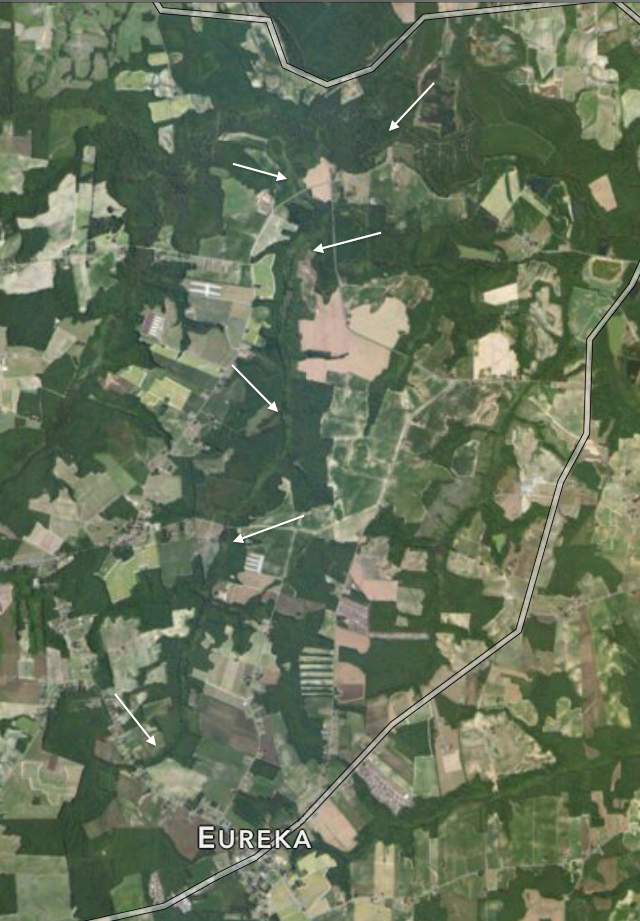
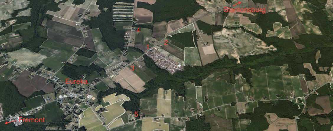
T. L. Hart died in Iredell county, N. C., during the year 1930, having first made and published his last will and testament, which was duly probated by the clerk of the superior court of Iredell county, and recorded in the office of said clerk on June 4, 1930.

By his last will and testament, the said T. L. Hart devised his home place in Iredell county “to my daughter, Bertha May Hart and her bodily heirs, forever, never to be sold, and if she dies without bodily heirs, then it must be in trust for my sisters’ heirs, to hold but never to sell the same.”

By a codicil to his said last will and testament, the said T. L. Hart devised to his daughter, Bertha Mae Hart, a tract of land in Iredell county, containing forty-five acres, and described in the complaint by metes and bounds.

At his death, T. L. Hart left surviving as his only heir at law his daughter, Bertha Mae Hart, who has since intermarried with the plaintiff W. J. Murdock. He also left surviving five sisters, three of whom are married. Each of these sisters has children. Neither of his two unmarried sisters has children. Both are now over fifty years of age.

On April 1, 1935, the plaintiffs and the defendant entered into a contract in writing, by which the plaintiffs agreed to convey to the defendant a fee-simple estate, free and clear of all liens or incumbrances, in two tracts of land, one tract containing twelve acres, and being a part of the home place of T. L. Hart, deceased, which was devised to the feme plaintiff by the said T. L. Hart in his last will and testament, and the other tract containing forty-five acres and being the tract which was devised to the feme plaintiff by T. L. Hart, deceased, by the codicil to his last will and testament. By said contract, the defendant agreed to pay to the plaintiffs the sum of $1,000, upon the execution and delivery to him by the plaintiffs of a deed conveying both said tracts of land to the defendant, in fee simple, in accordance with said contract.

The defendant has refused to accept the deed tendered to him by the plaintiffs, and has declined to pay the plaintiffs the sum of $1,000, in accordance with said contract, on the ground that the feme plaintiff is not the owner of an indefeasible estate in fee simple in said tracts of land, and for that reason the plaintiffs cannot convey to him such an estate in said lands, in accordance with their contract.

On these facts the court was of opinion and so held that the feme plaintiff is the owner of an indefeasible estate in fee simple in the forty-five-acre tract, but that she is not the owner of such an estate in the twelve-acre tract.

It was accordingly ordered, considered, and adjudged that plaintiffs are not entitled to the specific performance by the defendant of the contract set up in the complaint, and that the defendant recover of the plaintiffs the costs of the action. The plaintiffs appealed to the Supreme Court, assigning as error the holding of the court that the feme plaintiff is not the owner of an indefeasible estate in fee simple in the twelve-acre tract described in the complaint.

Opinion

CONNOR, Justice.

There is no error in the judgment in this action. By virtue of the last will and testament of her father, T. L. Hart, deceased, and under the statute, C. S. § 1734, the feme plaintiff is the owner of an estate in fee simple in the twelve-acre tract described in the complaint. This estate, however, is defeasible upon the death of the feme plaintiff without bodily heirs. Whitfield v. Garris, 131 N. C. 148, 42 S. E. 568, and Id., 134 N. C. 24, 45 S. E. 904. It is clear that the words “bodily heirs,” used by the testator, must be construed as meaning children or issue; otherwise the limitation over to the heirs of the sisters of the testator would be meaningless. Rollins v. Keel, 115 N. C. 68, 20 S. E. 209. See Pugh v. Allen, 179 N. C. 307, 102 S. E. 394.

The limitation over to the heirs of the sisters of the testator, upon the death of the feme plaintiff, without bodily heirs or issue, is not void. The provision in the will that the home place of the testator, which includes the twelve-acre tract described in the complaint, shall not be sold by either the feme plaintiff or the remaindermen is void as against public policy. This provision, however, does not affect the validity of the devise either to the plaintiff or to the remaindermen. See Lee v. Oates, 171 N. C. 717, 88 S. E. 889, Ann. Cas. 1917A, 514.

There is nothing in the codicil which affects the estate in the home place of the testator devised in the will to the feme plaintiff.

The judgment is affirmed.

Standard
Births Deaths Marriages, Land, Migration, Paternal Kin, Photographs

Where we lived: gentrified DC.

When she died in 1993 in Washington DC, the estate of Arnetta L. Randall, seventh of George and Fannie Aldridge Randall‘s nine children, included her home at 1377 Florida Avenue NE.

As has much of DC, Cousin Arnetta’s section of Near Northeast has undergone considerable change in the last decade. Her estate sold the house on 18 January 2001 for $12,000. Fourteen months later, it went for $135,000. Three and a half years later, the property again changed hands, this time for $191,000. Its owner held on during the real estate collapse of 2008, then sallied forth into a resurgent market in 2011. On January 25 of that year, he sold for $315,000.  The climb continued: two years later, in February 2013, the house sold for $485,000.

There is surely no part of this Arnetta Randall would have recognized. Neither the astounding amounts that have changed hands over her small two-bedroom rowhouse nor the house itself, renovated in its every nook and cranny and painted a bright yellow on its way to a half-million dollars.

Standard
Births Deaths Marriages, Free People of Color, Land, North Carolina, Paternal Kin, Photographs

Where we lived: Adam Artis’ Eureka.

Adam Artis bought and sold hundreds of acres in northeast Wayne County in the last half of the 19th century. Almost 160 years after he filed his first deed, his descendants remain on pockets of his land strung along Highway 222. More enduringly, their family cemeteries cluster east of Eureka toward Stantonsburg — at the heart of his erstwhile empire.

eureka artis

#1 marks the location of Adam Artis’ grave. His many wives and children notwithstanding, until the mid-1980s, his was the only readily identifiable grave in the plot.

#2 is the self-proclaimed “Historic John I. Exum” cemetery. Adam’s kin intermarried considerably with Exums, including his granddaughter Cora Artis, who married John Ed Exum, and his sister Delilah Williams, who married Simon Exum. Delilah and Simon, however, are buried at #3, along with several of their descendants.

Red Hill Road debouches into 222 across from #3. Not a half-mile back up the road, at least two and possibly four of Adam’s sons rest. Noah and June Scott Artis are buried in #4 with several of June’s offspring, as well as their brother Robert‘s wife and their brother Henry J.B.‘s wife and children.

About a half-mile, as the crow flies, south of #3 is #5, which contains the graves of Adam’s son William M. Artis and his descendants, as well a daughter of Adam’s brother Jesse Artis.

The road snaking northwest out of Eureka becomes Turner Swamp Road past the city limits. Just off the edge of this map, perhaps a mile up the road, stands Turner Swamp Baptist Church, once led by Jonah Williams, brother of  Adam Artis, Jesse Artis and Delilah Williams Exum. A sizeable cemetery lies behind the church, and it contains the graves of Magnolia Artis Reid, daughter of Loumiza Artis Artis, who was another Artis sibling, as well as descendants of Zilpha Artis Reid and Richard Artis, yet more siblings. Turner Swamp itself appears as a dark green curve bracketing the upper left corner of the photo. It is likely that the original location of the church was north along the banks of the waterway, at the site where the overgrown graves of Jonah Williams and his family lie.

Back in the other direction, east on 222 toward Stantonsburg, lies Watery Branch Road. (The branch itself is the dark green sword piercing more than halfway into the frame from the right.) Perhaps a quarter-mile, if that far, down the road on the right lies the Diggs cemetery, another small family graveyard. Celia Artis, born about 1800, the wealthiest free woman of color in Wayne County, was the Diggs’ matriarch. She and Adam Artis’ kinship, if any, was unknown even to them. Two of Celia’s great-granddaughters married a son and a grandson of Adam Artis. Leslie Artis, his wife Minnie Diggs Artis, and some of their descendants are buried here.

Standard